What is Danti?
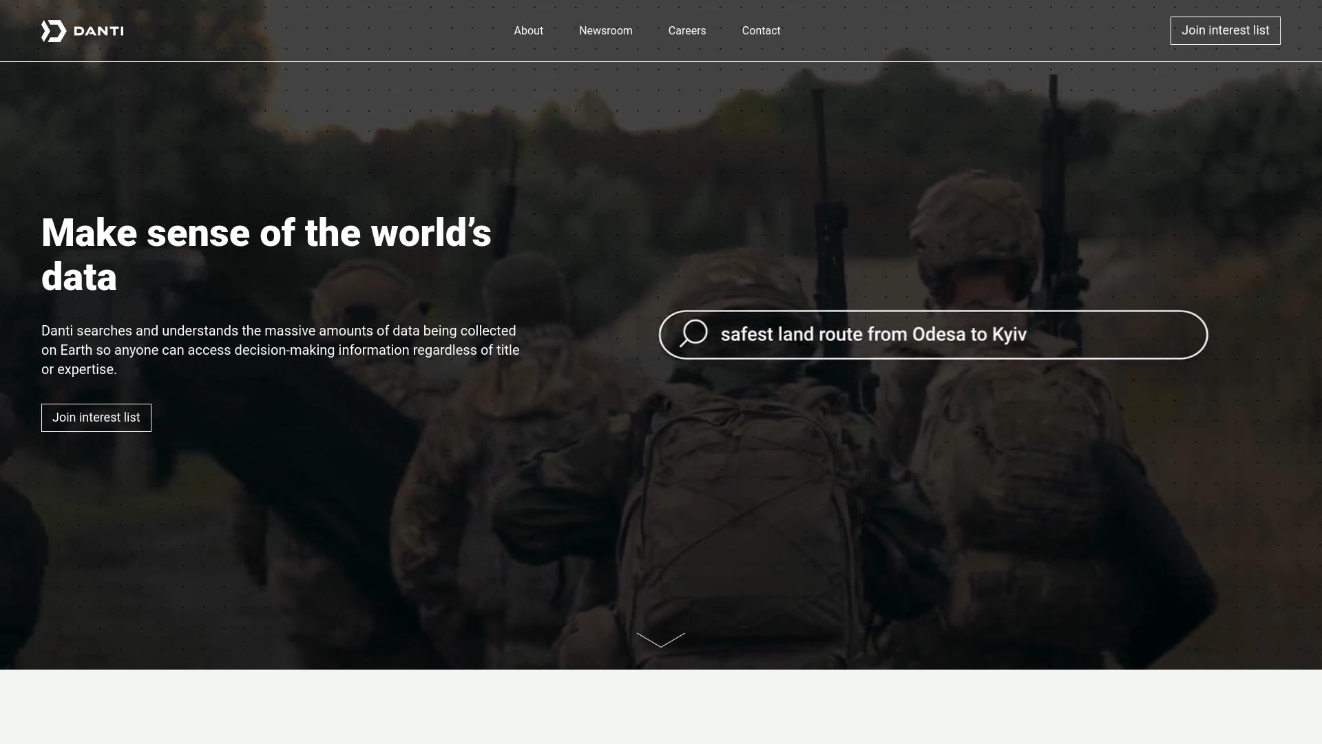
Danti is an innovative tool designed to unlock the potential of Earth observation data. With its advanced search capabilities, Danti enables users to explore vast collections of Earth data with ease, transforming complex datasets into actionable insights. It caters to professionals in industries such as defense, real estate, insurance, and research, while also being accessible to data enthusiasts.
Key Features:
- Advanced Search Capabilities: Utilizes natural language processing to deliver precise and context-specific search results.
- Wide Range of Data Sources: Integrates data from various sources such as permits, satellite imagery, news articles, and more.
- User-Friendly Interface: Intuitive design suitable for both novices and experts.
- High Customizability: Offers deployment options on the web or within organizational firewalls to meet diverse needs.
Pros
Enhanced Data Accessibility: Makes complex Earth data easy to access and analyze.
Time Efficiency: Reduces the time needed to locate and use relevant data.
Cost-Effective: Removes the need for costly data management infrastructure.
Expert-Level Precision: Allows users with minimal geospatial expertise to perform advanced analyses.
Cons
Complexity of Data: Users might find the volume of data overwhelming without proper training.
Dependency on Technology: Requires strong internet connectivity and infrastructure.
Limited by Current Technology: Some advanced features are still under development.
Who is Using Danti?
- Defense & Intelligence Agencies: Access critical data without needing geospatial analysts.
- Real Estate Professionals: Gain insights into properties and geographical areas.
- Insurance Companies: Assess risks and understand property details in depth.
- Infrastructure Companies: Manage and interpret extensive internal datasets.
- Uncommon Use Cases: Educational researchers and environmental scientists tracking land use.
Pricing:
- Free Tier: Basic features with limited data access.
- Pro Tier: Starting at $99 per month, includes full access to data sources and advanced tools.
Disclaimer: Please visit the official Danti website for the most accurate and up-to-date pricing information.
What Makes Danti Unique?
Danti democratizes access to Earth observation data, providing expert-level analysis through an intuitive platform. Its ability to make complex data accessible to users with minimal expertise sets it apart from other tools in the market.
Compatibilities and Integrations:
- Cloud-Based Solutions: Fully compatible with major cloud platforms for scalability.
- API Access: Offers robust API options for custom integrations.
- Multi-Platform Support: Accessible across various devices and operating systems.
- Security Features: Incorporates advanced security protocols to ensure data confidentiality.
Danti Tutorials:
Danti provides a variety of tutorials on its website, helping users learn everything from basic setup to advanced data analysis techniques.
How We Rated It:
- Accuracy and Reliability: 4.8/5
- Ease of Use: 4.7/5
- Functionality and Features: 4.9/5
- Performance and Speed: 4.6/5
- Customization and Flexibility: 4.5/5
- Data Privacy and Security: 4.8/5
- Support and Resources: 4.3/5
- Cost-Efficiency: 4.4/5
- Integration Capabilities: 4.5/5
- Overall Score: 4.6/5
Summary:
Danti transforms Earth observation data into actionable insights, making it an essential tool for professionals in industries such as defense, real estate, and insurance. Its user-friendly design and advanced features enable users to perform expert-level data analysis with minimal effort, redefining how we interact with geospatial data.